
Bell ZIP Coverage
Bell has one verified standard ZIP code: 90201. Every verified City of Bell address uses it. That fact is useful, but it does not turn 90201 into a city roster. The directory starts with delivery reach, so the first row also includes a substantial Bell Gardens and Cudahy delivery area. A mailing label can therefore cross a municipal edge, while the custodian for a parcel, deed, permit, or voter record depends on jurisdiction and record type. For Los Angeles County research, keep the mailing address, city name, and parcel location as separate clues.
| ZIP | Areas Covered | Post Office | Notes |
|---|---|---|---|
| 90201 | Bell plus a substantial Bell Gardens and Cudahy delivery area | Bell Gardens PO, 7001 Garfield Ave; Cudahy facility, 4619 Elizabeth St | Only standard Bell ZIP verified; not coterminous with the city |
The Bell Gardens post office and the Cudahy facility show how the 90201 delivery area reaches beyond Bell. No second standard ZIP serving Bell was verified in the research. There is also no verified basis for adding a PO-box-only or unique-ZIP row. For a family-history or address check, record the exact city line and street address before treating 90201 as proof of Bell jurisdiction.
Beyond Bell's 90201 Area
A postal code is a delivery label. It is not drawn to match an incorporated city line. The 90201 area is associated with Bell, Bell Gardens, and Cudahy delivery facilities, so a ZIP-keyed result can combine Bell addresses with nearby municipal areas. A directory can narrow a lead, but it cannot decide which city clerk, parcel office, or county custodian should answer a records request.
Bell is an incorporated Los Angeles County city. Municipal records, county parcel files, county deeds, and election records sit with different offices even when a mailing label looks the same. The Bell general plan and geography material is useful context for the city line, but a plan page does not replace an address or AIN check. When the delivery city and municipal city differ, preserve both labels and ask the responsible custodian to confirm coverage.
Note: A mailing city is a delivery clue, while municipal jurisdiction should be confirmed through the parcel map or the responsible records custodian.
Narrowing Bell by ZIP
No Bell portal accepts 90201 and returns every resident. The practical directory workflow is a narrowing chain. Start with a complete address or a known name and year when possible. Then use the ZIP as a check against the address, not as a substitute for a record key.
- Confirm the ZIP and delivery city with the USPS location information for the 90201 area. Keep the mailing label separate from the city claim.
- For a known street address, use the Los Angeles County Assessor Portal to search by address or ten-digit AIN. Capture the situs address and parcel facts; the public result does not expose an owner name.
- Use the Assessor map or LA County GIS-NET with an address, AIN, or intersection to check parcel location and nearby geography. Bell is incorporated, so county unincorporated zoning layers are not Bell zoning.
- For your own registration, use California My Voter Status with the required identity fields. A permitted voter-file request follows the state request rules and stated purpose; it is not a casual ZIP browser.
- For a deed or recorded instrument, carry the relevant name and recording year to the Los Angeles County Registrar-Recorder/County Clerk. Its Norwalk index uses grantor, grantee, and year, not a street or ZIP search.
At each step, preserve exact spelling, the full street address, the city shown by the custodian, and any AIN. Once a ZIP narrows the lead to a street, the Bell street directory provides the address-focused next step without treating a parcel as a resident roster.
Bell Search Fields for 90201
Official channels do not share one ZIP search form. The Assessor and GIS routes are address-keyed. The RR/CC real-estate index is name-and-year keyed. Voter status is an authenticated self-check. That division matters because a directory may suggest where to look, while the underlying record system may reject ZIP as an input.
| Portal or Route | Field or Control | Type and Requirement | ZIP Relevance |
|---|---|---|---|
| LA Assessor Portal | Search by AIN or Address | Autocomplete text; one value | Finds parcel and situs facts; no ZIP-wide resident result or public owner name |
| Assessor Map Search | Map Search | Map control; optional | Zoom, pan, and select parcel polygons; it does not create a resident list |
| GIS-NET | AIN, address, or intersection | Text or map controls | Supports map layers, identify, query, and buffer tools; Bell zoning remains a city question |
| RR/CC real-estate index | Grantor or grantee name and recording year | Office index; name and year needed | No street, ZIP, or APN search; discovery is at Norwalk |
| California My Voter Status | First name, last name, DOB, DL or ID, SSN last four | Name and DOB required; identity number conditional | Authenticated self-service only, not a public reverse directory |
AIN means Assessor Identification Number. In Los Angeles County it is a ten-digit map book, page, and parcel code. The AIN is a stronger parcel key than a ZIP because it points to a mapped assessment unit. It still does not prove that an owner lives there. For deed research, the Los Angeles County RR/CC requires a different search path, and its office-only index cannot be replaced by the Assessor map.
Bell ZIP, ZCTA, and City
Three labels can look alike in a search result but answer different questions. A ZIP code describes mail delivery. A ZCTA is a Census geography built from whole blocks to approximate a frequently occurring delivery ZIP. A city jurisdiction is the legal municipal area used to decide which local government holds a city record. None of these labels, by itself, proves who occupies an address.
- ZIP
- A postal delivery area used to sort and route mail. It can cross a city line.
- ZCTA
- A Census whole-block approximation of a frequently occurring delivery ZIP, not an operational USPS boundary.
- City jurisdiction
- The municipal boundary that controls city authority and local custodians. It is not set by the ZIP.
- ZIP+4
- The extra four digits that narrow delivery within a five-digit ZIP; it does not create a new city.
- PO-box ZIP
- A ZIP used for post-office-box delivery. No Bell-specific PO-box-only ZIP was verified.
- Unique ZIP
- A ZIP assigned to one high-volume organization or address. No Bell-specific unique ZIP was verified.
- Carrier route
- A postal delivery route inside a ZIP. It is a routing concept, not a resident or city boundary.
The ZCTA and the city line should stay separate in a Bell directory. The 2020 Census ZCTA for 90201 had 95,810 people, but that figure covers the Census approximation, not only Bell. Bell's population was roughly 31,930 around 2024. The different years and geographies make the figures useful for scale, not for identifying residents.
Bell's 90201 Numbers
The 95,810 figure attached to the 2020 ZCTA and the roughly 31,930 figure associated with Bell around 2024 are not competing counts. They measure different boundaries at different times. The larger ZCTA value reflects the delivery area that includes substantial parts of Bell Gardens and Cudahy, while the Bell estimate describes the incorporated city.
Numbers can still help with source selection. A ZIP-sized population is too broad for a city-only resident conclusion. A city-sized estimate is too narrow to describe every address carrying 90201. For genealogy, civic curiosity, or a record request, use the number as geography context, then return to the exact address, AIN, name, year, or authenticated account that the custodian actually accepts.
Bell Geography Inside 90201
Bell covers 2.81 square miles in two parts, Central City and Cheli. The Los Angeles River and I-710 divide the parts, while the city remains an incorporated place. Central City generally runs from Randolph Street toward Florence Avenue. Cheli is the industrial area north and east of the river and freeway. This compact but split shape makes the parcel map more useful than a ZIP label when a record request depends on the city line.
The geography also explains why a ZIP directory needs a local caution. An address in Central City or Cheli may be a verified Bell address with 90201, while the wider delivery area reaches Bell Gardens and Cudahy. Do not infer a ZIP split, neighborhood boundary, or city realignment from the river, freeway, or a post-office name. The research found no official Bell ZIP split or realignment notice.
Note: Central City and Cheli are city geography; 90201 is delivery geography, so the two layers should not be merged.
Bell ZIP to AIN Research
Parcel work should shift from ZIP to address and AIN as soon as a street location is known. The situs address is the physical parcel location. A mailing address is correspondence information and may not match the situs. The Assessor portal can search by address or AIN and show parcel characteristics, assessed panels, map information, and effective dates. Public web results intentionally omit the owner and mailing address, so an owner question needs the Assessor contact, counter, or Specific Property route.
The county tax-payment history route is also AIN based and covers the last three fiscal years. It can support parcel research, but it does not turn a payer into an occupant or a ZIP into a resident directory. GIS-NET adds address, AIN, and intersection tools, plus identify, query, buffer, export, report, and print controls. Because Bell is incorporated, use those tools for geography and parcel context, not as a substitute for Bell zoning or a city resident list.
The useful chain is simple: ZIP clue → complete address → AIN and situs → correct custodian. Keep the legal description when available. It can link a parcel across a mailing-label change better than a ZIP alone.
Bell Boundary Checks for 90201
Edge addresses deserve a final jurisdiction check before a request is sent. Bell City Clerk and the Bell city records portal cover municipal files and selected PDFs. The Los Angeles County Assessor handles parcel facts, the RR/CC handles recorded real-estate instruments, and Los Angeles County election offices handle county voter-record requests. A shared ZIP does not move one office's records into another office's system.
The Los Angeles County voter information request page is the source linked to the assigned image below. It represents a purpose-specific county route, not a ZIP-wide resident roster.
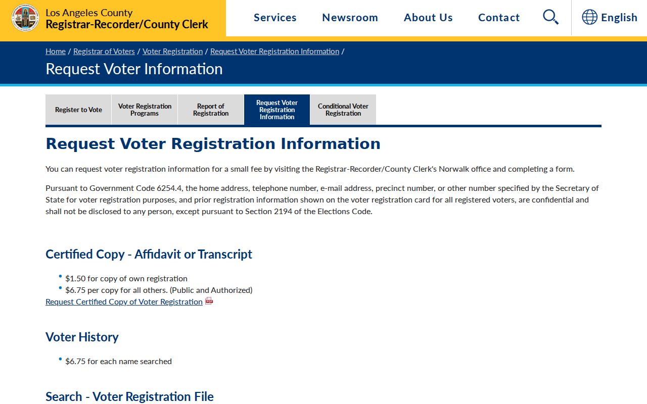
The voter route reinforces the difference between a lawful records request and a casual 90201 query. It does not make another person's registration status available through a public ZIP search. Preserve the request purpose and use the county or state instructions that match the record.
The research did not locate an official Bell ZIP split or realignment, a PO-box-only or unique ZIP assignment, or the exact municipal E911 address-assignment procedure. These are verification gaps, not proof that no later notice or internal procedure exists. For an unresolved edge address, send the full street address and any AIN to the relevant custodian rather than infer emergency or municipal jurisdiction from the ZIP.