
Tracing a Bell Street, Step by Step
A street-by-street search works best when each address is treated as a separate record trail. Start with the physical address in the Los Angeles County Assessor Portal. The result supplies the ten-digit Assessor Identification Number, or AIN, plus the situs address and parcel or assessment facts. Carry that AIN into the map view, then ask the Assessor for owner information through the documented offline route. A deed search comes later because the Los Angeles County Registrar-Recorder/County Clerk does not index deeds by street or APN. Voter data cannot supply a public roster, and a permit file can show work at a property without proving who lived there. The goal is a careful sequence, not a single list of Bell residents.
- Enter the exact Bell address in the Assessor's address search. Save the returned AIN, situs wording, map result, and any parcel-change clue before moving on.
- Open the parcel map and compare the selected polygon with adjoining parcels. Use the address and AIN together if a typed address or map label looks different.
- Request the owner through the Assessor's phone, counter, or Specific Property contact route. Treat the name as an ownership lead, not proof of occupancy.
- Take the confirmed owner name and a recording year to the RR/CC index in Norwalk, or send a mail request with the required document and party details. Follow grantor and grantee roles to extend the chain.
- Ask Bell Building & Safety or use the city CPRA request channel for a focused permit, inspection, or code record by address, AIN, and date span. Use library and census leads only as historical occupancy evidence.
That sequence can be expressed as address to AIN to parcel context to owner request to deed name and year. A second trail runs from address to a permit or code case, while a third uses approved voter channels for a limited registration purpose. Keeping these trails separate prevents a deed party, parcel owner, registered voter, and past directory occupant from being treated as the same person.
Bell Street Records by Address
A Bell street directory is a set of address-keyed sources, not one county database. Each row below answers a distinct question. The Assessor and GIS tools work from address or AIN. The recorder starts with names and years. Tax payment history stays tied to an AIN and covers only the last three fiscal years. Bell's municipal files require a direct request, and voter information carries purpose limits.
| Record trail | Keeper | What it can show | Access path |
|---|---|---|---|
| Parcel and assessment | Los Angeles County Assessor | AIN, situs, assessed characteristics, and value panels | Free address or AIN web route; owner offline |
| GIS parcel | County GIS and Assessor layer | Polygon, AIN, situs, agency name, and adjacent context | Free map with identify, query, and buffer tools; no person roster |
| Recorded real estate | RR/CC Recorder | Grantor and grantee, instrument and date, and legal description | Norwalk name and year index; in-person or mail copies |
| Tax payment history | Los Angeles County tax office | AIN, address, and the last three fiscal years | Free AIN search; no resident identity |
| Permits and code cases | Bell Community Development | Project, application, inspection, or code evidence | Building & Safety, Code Enforcement, or CPRA; public search not verified |
| Voter status or file | California SOS and LA County Elections | Authenticated status or approved-purpose data | Self-check or restricted request; no public street browser |
Use the rows in order when the purpose is address research. A parcel result establishes a land reference. GIS adds spatial context. An owner request supplies a name that can be taken to the recorder. A deed supplies a recorded transaction, while tax history supplies a narrow payment record. Bell permits can corroborate a change at the property. None of those steps creates a complete list of people along a street. That distinction is the core of a reliable street directory.
Bell Street Assessor and GIS Fields
The Los Angeles County Assessor Portal is the cleanest starting point for Bell address research because it asks for the physical location rather than a person's name. Basic Search and Legal Search provide alternate modes, while Map Search lets a researcher inspect a parcel visually. The county parcel layer exposes AIN, situs address, and agency name. The portal is free, but its public web result deliberately omits owner name and mailing address. An ownership-tab label does not change that access boundary.
| Control or field | Type | Required | Use and limit |
|---|---|---|---|
| Basic Search / Legal Search | Tabs | No | Alternate Assessor search modes |
| Search by AIN or Address | Autocomplete text | One value | Ten-digit AIN or street address |
| Map Search | Map and button | No | Zoom, pan, and select a parcel |
| AIN | Text identifier | Alternative | Ten digits: map book, page, and parcel |
| Address | Text or autocomplete | Alternative | Parcel or situs search |
| GIS-NET address, AIN, or intersection | Text and map | No | Area navigation and county planning context |
| Identify or select | Map tool | No | Click an adjacent polygon or feature |
| Buffer, query, layers, aerials, export, report, print | Map controls | No | Compare, document, or print parcel context, not a resident roster |
The Los Angeles County GIS-NET public page shows the address, AIN, and intersection controls used for parcel context:
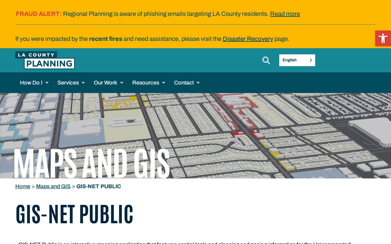
The map view makes adjacency and agency context easier to inspect, but it does not add an owner name or turn a parcel polygon into a resident roster.
When an older AIN fails, check the parcel-change information rather than assuming the land has no history. Preserve the typed address, returned situs, AIN, and legal description together. The Assessor result is an assessment and parcel record, not a statement that an owner occupies the dwelling. A map polygon can also show that two addresses touch without proving that the same people live in either place.
Note: A changed parcel can retain historical value even when a current AIN no longer returns the earlier record.
Bell Address Definitions
Address terms carry different evidentiary weight in a Bell street directory. Using the right term keeps an online parcel result from being mistaken for a deed, tax notice, or household record. The same physical land can have a situs label, a mailing destination, a legal description, and an AIN that serve different offices.
- Parcel
- A defined piece of land represented in the Assessor and map systems. Its record describes land and assessment characteristics, not every person who uses a building.
- Situs address
- The physical location assigned to the parcel. It is the address used to begin an Assessor or map search.
- Mailing address
- The correspondence destination for tax or other notices when supplied by the custodian. It may differ from the situs and is not visible in the public Assessor result.
- Legal description
- The formal land identity, such as lot, block, or tract information, that helps keep a deed tied to the correct land when address labels change.
- AIN
- The ten-digit Assessor Identification Number built from map book, page, and parcel components. It bridges the Assessor, GIS, and tax-payment systems.
These definitions matter when an address is close to Bell's boundary or when an old record uses a different label. Keep the situs and legal description as separate evidence. Do not replace a missing owner name with a mailing address, and do not treat a parcel's agency name as a zoning ruling for incorporated Bell.
Getting Bell Owner Data Offline
The Assessor's web route stops at the parcel. To request the owner, use the Assessor's documented contact or counter channels with the exact Bell address and AIN. The research identifies 888-807-2111 and 213-974-3211, a district counter, and the contact form's Specific Property route. This is the practical insider step in a Bell street directory: obtain the parcel online, then request the name from the custodian instead of expecting a hidden web field to appear.
Insider tip. Ask for the owner only after recording the AIN and situs exactly. If the name is supplied, treat it as an ownership lead and confirm the land through a deed or legal description.
Assessor owner route
888-807-2111 or 213-974-3211
Use a district counter or the Specific Property contact path with the AIN and address.
Tax history route
Shows the last three fiscal years and does not identify a resident or establish occupancy.
The tax route is a useful check on the parcel, but it is not a substitute for the owner request. A payment record may confirm that the AIN is valid while leaving the payer, occupant, and owner roles unresolved. Keep those limits visible in notes and in any family-history or property-history work.
Bell Street Deeds at Norwalk
The Los Angeles County Registrar-Recorder/County Clerk changes the search from an address question to a name-and-year question. The RR/CC real-estate viewing instructions state that the index is arranged by grantor, grantee, and recording year, not by street address or APN. Grantor means the party transferring an interest; grantee means the party receiving it. At the Norwalk office, the physical index divides 1851 through 1957 on the lower level and 1958 to the present on the second floor.
There is no online deed index to browse by Bell street. Telephone staff do not conduct index searches. In person is the strongest discovery channel when a researcher has a name and year. Mail is the fallback when travel is not practical. A mail request needs the document title, known party names, and exact or bounded recording year or years. The county states that mail processing can take up to 20 working days.
The RR/CC mail request instructions show the identification details needed for a copy request:
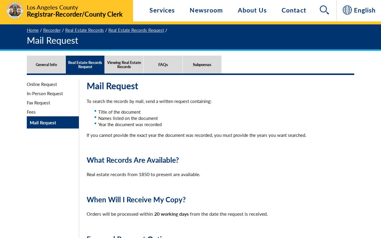
The mail route is useful after the parcel and owner steps have supplied a workable name and year. It is not an address-search shortcut, and the AIN serves as corroboration after discovery rather than the recorder's index key.
The RR/CC fee schedule separates name-and-year index work from copies. The published index search charge is $0.50 per name per year with a $1 minimum. A plain copy is $5 for the first page and $3 for each additional page; a certified copy is $6 for the first page and $3 for each additional page.
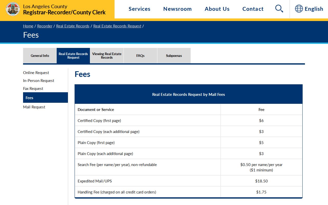
Those charges explain why a focused request matters. Identify the likely owner, recording period, document type, and copy type before ordering. Complete documents, rather than a guessed page, are the useful link between a named transaction and the Bell parcel.
Note: An Assessor-derived AIN or legal description helps confirm a deed after the Norwalk index returns a name and year.
Bell Address Permits and Code Cases
Permits and code cases add a municipal layer to the street record, but Bell does not have a verified public address search that can be described as complete. The Bell Community Development department is the route for Building & Safety, Code Enforcement, planning, and related contacts. The OpenGov permits landing page existed during research, yet no working public search or stable field set was verified. Do not promise that typing an address into that landing page will return a full permit history.
Use Building & Safety for a focused permit, plan, inspection card, or certificate request. The research lists 323-588-6211 extension 2611 and psanchez@cityofbell.gov for permit contact. Code Enforcement can be approached at rarriola@cityofbell.gov, extension 2618, for address-keyed cases or complaints subject to exemptions. Walk-in City Hall and Community Development access is available Monday through Friday from 8:00 a.m. to 4:00 p.m.; appointments are encouraged. If a staff or published-page route does not resolve the record, submit the exact address, AIN, record category, and date span through the Bell CPRA request form. Bell states a ten-day determination and a possible written fourteen-day extension.
A permit can identify an applicant, owner, contractor, or date of work, but it does not establish who lived at the address. Code complaints may also contain protected or law-enforcement information. Request one record type and one date range at a time, then compare the result with the parcel and deed trail.
Bell Street Voter Limits
California My Voter Status is an authenticated self-check, not a public Bell street browser. The California voter status portal asks the voter for first name, last name, date of birth, and either a California driver license or identification number or the last four digits of a Social Security number, with a no-number option. An authenticated result can show registration status and location, party preference, language preference, polling and election information, and vote-by-mail or provisional status. Vote history means participation, not ballot choice.
LA County Elections request channels are the separate route for other access. The research documents an individual's certified registration at $1.50, another authorized or public copy at $6.75, voter history at $6.75 per name, and a file search at $5 per name. Mail requests go to the Election Information Section at 12400 Imperial Highway, Room 2013, Norwalk, with requester name, address, date of birth, signature, telephone, and a stamped return envelope. Phone support is 800-815-2666 option 4, and the listed email is voterinfo@rrcc.lacounty.gov. Bulk countywide, precinct, district, or city files require a signed purpose declaration and carry the published file fees.
California election law limits voter information to election, scholarly, journalistic, political, or governmental purposes and prohibits commercial use. An ordinary public-records request cannot be used to evade those limits. For a Bell street directory, the correct conclusion is that an authenticated voter can check their own record and an approved requester can seek a permitted file. Neither route supplies a casual list of everyone registered along a street.
Bell Streets, 90201, and City Limits
The research verified 90201 as the standard ZIP used for Bell addresses, but that ZIP also serves substantial delivery areas in Bell Gardens and Cudahy. A ZIP match therefore narrows a search without proving municipal jurisdiction. Mailing city, ZIP, parcel agency name, and Bell city limits can point to different custodians. Confirm the city before sending a permit request or treating a map result as a Bell record.
Bell's municipal geography has two parts. Central City generally runs between Randolph Street and Florence Avenue. The Cheli area lies north and east of the Los Angeles River and freeway and carries industrial and warehouse activity. The two parts are connected through the river and I-710 setting, but a ZIP directory or county map does not replace the city boundary. GIS-NET is principally a planning tool for unincorporated county territory, so its county zoning layer is not Bell zoning. Parcel shape, situs, and agency name remain useful even when a county planning layer does not apply.
Keep 90201 as a delivery clue, not a resident filter. An address search, AIN, and agency check are stronger than a ZIP-only assumption when a Bell street lies near a neighboring city.
Note: A ZIP match narrows a search but does not settle whether a record belongs to Bell or a neighboring city.
Bell's Pre-1927 Street Record Trail
Bell's incorporation creates a real custody divide in address research. Bell incorporated on November 7, 1927, so earlier ownership and land history belongs chiefly to county deed, townsite, subdivision, census, and other regional sources rather than a Bell municipal permit series. The Bell Library began in 1913. A May 1922 Sanborn set contains 20 sheets for Bell and Maywood, which makes it useful for structure, use, and footprint context but not proof of a resident's identity.
The Bell Library's services and research contact can help with local questions, while the 1922 Bell and Maywood Sanborn record provides a digitized map source. Exact Bell city-directory and criss-cross year runs remain unresolved in the research. Ask library staff for the title, publisher, inclusive years, call number, format, and whether a reverse street section exists. The historical shelf and its inspection method are developed further on the Bell city directory page.
No official Bell street-renumbering event was located in the reviewed sources. Address continuity is therefore unverified across older records. Preserve the legal description and AIN, compare the map footprint, and treat a directory occupant as a historical clue rather than a current conclusion. A 1922 map can show a structure before incorporation; it cannot fill a missing owner or household record by itself.
The Bell Street Directory's Privacy Boundary
A street directory can organize public record paths, but it cannot lawfully turn them into a complete resident roster. Parcel and deed records center on land and recorded parties. Tax history shows AIN-linked payment history, not who paid or lived there. Permits show documented work, not a household. Voter channels are restricted. DMV and utility customer addresses are not public directory material. No parcel source supplies a complete occupant list or household roster, and a name appearing in one record does not prove a present connection to the address.
The owner may be an entity or an absentee owner. A registered voter may have moved. An old directory occupant may be useful for family history while saying nothing about today. A no-result can reflect a spelling variant, date gap, different custodian, protected record, or index limitation. Verify the role supplied by each source and ask the responsible office when a conclusion matters.
Lawful use. Bell street and address records are for personal, lawful research, such as house history, family reconnection, or civic curiosity. Do not use an address trail to stalk, harass, intimidate, or harm anyone. California law can impose criminal or civil consequences for misuse.